Geremia
- University of Genoa (IT)
- ECOLOGICAL SERVICES PORT OF GENOA SRL (IT)
- Port System Authority of the Eastern Ligurian Sea (IT)
- Higher Institute for Environmental Protection and Research (IT)
- Université de Toulon (FR)
- Institute for the Study of Anthropogenic Impacts and Sustainability in the Marine Environment (IT)
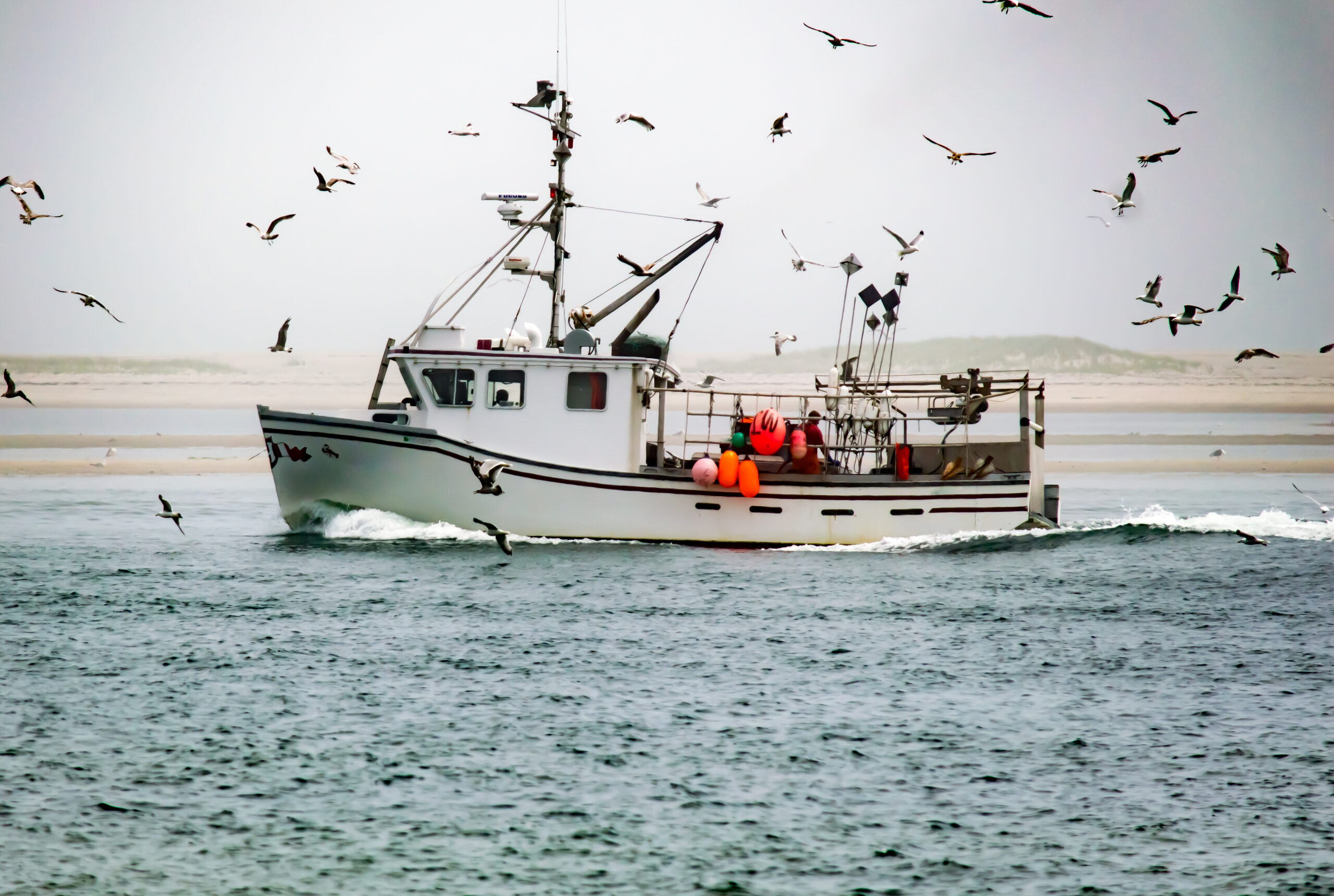
Managing Waste to Improve Port Waters
On a practical level, it translates into the implementation of a set of governance tools designed to prevent and contain pollution, improve water quality in the port area and develop innovative systems for assessing the quality of port water in the cross-border Italy-France area.
ETT took part in a project named GEREMIA – GEstione dei REflui per il MIglioramento delle acque portuali (GEREMIA – Managing Waste to Improve Port Waters), which aims to train and support port water-managers with practical and innovative tools and solutions.
The project
Funded within the framework of the 2nd Notice of the Italy-France Maritime Cross-border Cooperation Programme 2014-2020, the project enables the management of pollution risk on a cross-border basis, particularly in the Italy-France area, with a joint port water quality management plan, designed to reduce the risk of sewage pollution and its possible impact on adjacent marine areas. The actions implemented as part of the GEREMIA project involve port water monitoring by sampling and analysing various matrices (sediment, water, mussels and fish), modelling effluent dynamics and pollutant dispersion,installing effluent containment systems and defining an integrated index characterising the health of the port marine environment.
The DSS
The management strategy must therefore be able to deal effectively with an extremely dynamic system, which is why GEREMIA uses a Decision Support System (DSS) created to meet port requirements, garnered from monitoring and simulation model knowledge. The DSS makes differing levels of action intervention plans effective as it provides operational support to those making strategic decisions. The DSS makes effective use of all the resources and copious amounts of data available (combined information gathered from water, sediment and biota monitoring campaigns, risk mapping and the results of numerical simulations predicting pollutant dispersion dynamics in port waters) in various port scenarios in our country.
The role of ETT
ETT was responsible for the development, delivery, maintenance and training of the Decision Support System. The design and implementation of the tri-lingual system (Italian, English and French) were followed by a testing and debugging phase that led to the deployment of the DSS, thanks also to cooperation with the staff of the Department of Civil, Chemical and Environmental Engineering (DICCA) at the University of Genoa. Subsequently, a functional multimedia system user guide was produced, as well as a support and maintenance service that ETT will maintain for 12 months after testing. From the final delivery date of the DSS, ETT will also manage the hosting service for five years.
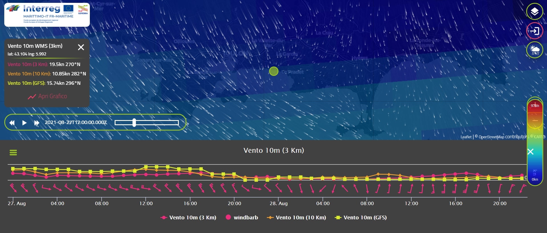
Four demos were set up for the project, in Toulon, Genoa, La Spezia and Olbia. For each of these, a vast amount of information was collected during monitoring campaigns and numerical simulations were carried out to predict the dynamics of pollutant dispersion in port waters. Both standard and innovative waste containment and bioremediation (environmental remediation) systems were installed during these pilot actions. Information from the monitoring campaigns is also used to implement modelling tools, permitting reports on weather forecasts, dispersion, and water quality to be displayed in real-time.
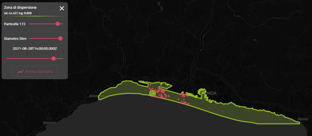
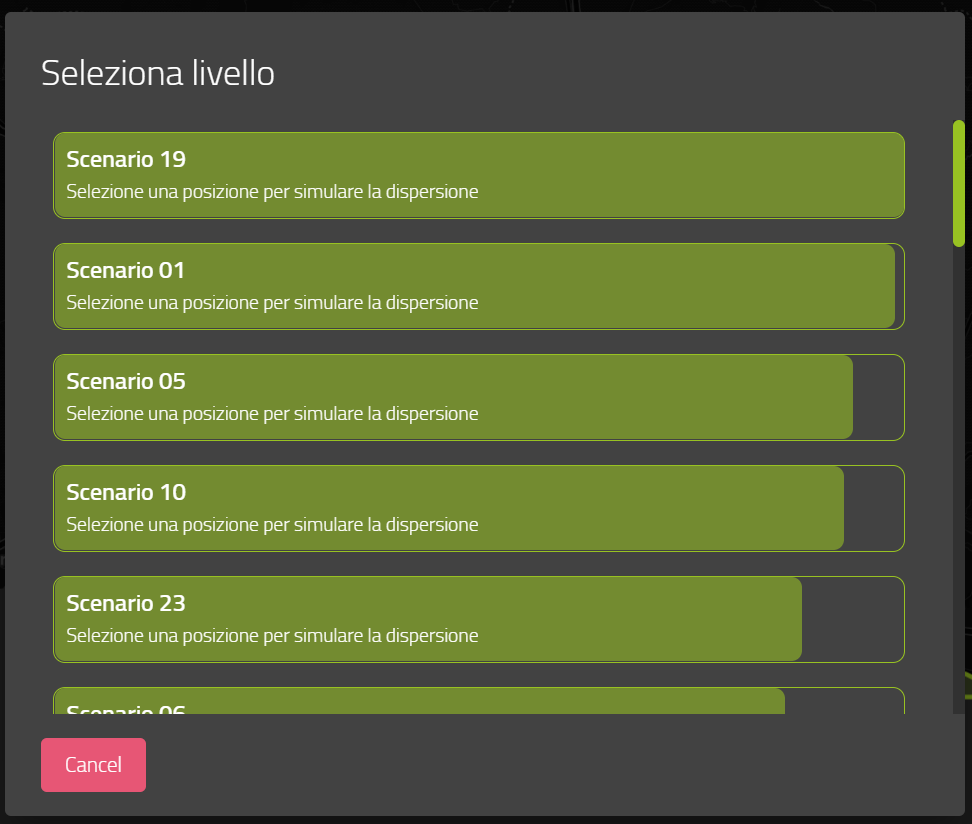
Each demonstrator shows related information on a map of the area. Forecasts for wind, cumulative rainfall over three hours, temperature and significant wave height can be observed. By selecting each of these levels and clicking on any point on the map, real-time animated information appears. Graphs may also be accessed to show the required information and highlight trends at different times. The DSS also extracts and compares data, at the same location, from all available models. The private section of the DSS accesses an animated simulation of different events (e.g. particle dispersion) based on real-time scenario data.
The numbers of the GEREMIA project
25
Simulated climate scenarios
76
Fish specimens analysed
42
Analysed mussels samples
29
Sediment samples tested
4
Numerical models of coastal and port circulation
25
Dispersion scenarios in different ports
95
Water samples collected
6
Campaigns carried out to measure dynamics
2
Fixed instruments installed in ports